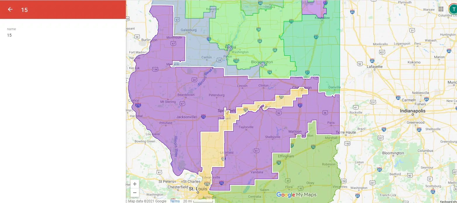
(Springfield, IL) — Illinois now has a new congressional district map. Governor Pritzker reviewed and signed the map into law yesterday. Pritzker said the maps align with the Voting Rights Act and will create equitable representation in the state’s congressional delegation. The new map creates a 17 congressional districts in the state for the next ten years, down from 18 during the last census term. A district near Chicago will provide more equitable influence for Latinos.
Fayette County will be part of the 15th Congressional District and is in the southernmost area of the district—as you can clearly see the county’s cutout in the district map. The district goes west and runs to just outside Edwardsville. It also goes east and northeast and will include Mattoon, Taylorville, Shelbyville and runs up to Decatur. Then it runs further and jags north and west and eventually takes in a massive swath of western Illinois and includes Quincy and runs all the way to just south of the Quad Cities.
###
Amy Becker/bs
Copyright © 2021
TTWN Media Networks Inc.


Comments